Crime Map of France
A new interactive crime map of the country is now available, which can be explored down to a municipal level.


Crime Map of France
16th April 2026
A new interactive crime map of the country is now available, which can be explored down to a municipal level.
Previously, crime statistics were typically presented at national or regional scales. This new tool goes further, offering detailed insights at the level of individual communes, where contrasts between urban and rural areas become much clearer.
The database includes recorded offences across 14 major crime categories, including burglary, violent theft, and assault causing bodily harm.
One striking finding is how geographically concentrated crime is. Across these categories, just 1% of municipalities (around 350 areas) account for 38% of residential burglaries and 82% of violent unarmed thefts. At the other end of the spectrum, 58% of municipalities reported no offences at all on average in 2025.
The map can be found at Géographie de la délinquance à l'échelle communale en 2025.
The information on the map can be analysed by department, type of crime and year, with records available from 2016.
It also features charts comparing each area with national trends, as well as showing how crime levels have evolved over the past decade.
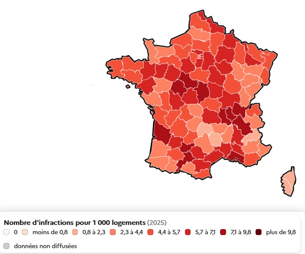
The graphic below illustrates burglary rates by department in 2025, ranging from fewer than 0.8 incidents per 1,000 properties to more than 9.8 per 1,000.
Related Reading:
You just read an issue of France Insider. You can also browse the full archives of this newsletter.